Cardai Hill Surface Mining Overlay
Project Update-Spring 2023
The Growth Management Hearings Board issued a Final Decision and Order on March 22, 2023 (Case No. 22-2-0002) addressing a separate non-project SMO application in Clark County. The Growth Board ruled that the County had improperly made a determination of non-significance with respect to that Surface Mining Overlay (SMO) application. The Growth Board concluded that the ordinance approving the SMO did not comply with Growth Management Act (GMA) and was invalid as interfering with the GMA goals because of the SEPA violation.
Based on the Growth Board’s decision the County’s responsible official has withdrawn the November 28, 2022, Determination of Non-significance (DNS) for the Cardai Hill SMO application OLR-2022-00014. Clark County has determined that the proposal is likely to have a significant adverse impact on the environment.
On April 5, 2023, Clark County issued a Determination of Significance (DS) with a request for Environmental Impact Statement (EIS) scoping comments. The deadline for comments is April 26, 2023.
No further action will be taken on the application until the EIS process is complete.
- Notice of Withdrawal of Determination of Non-Significance
- Determination of Significance-Request for comments on scope of Environmental Impact Statement
- Environmental Impact Statement Scoping Comments
- Consultant Letter to County Council
- Friends of Clark County DNS Appeal Withdrawal Letter
- Cardai Hill EIS Post Scoping Letter
- Cardai Hill SMO Expired DEIS Letter_Signed
Project Summary
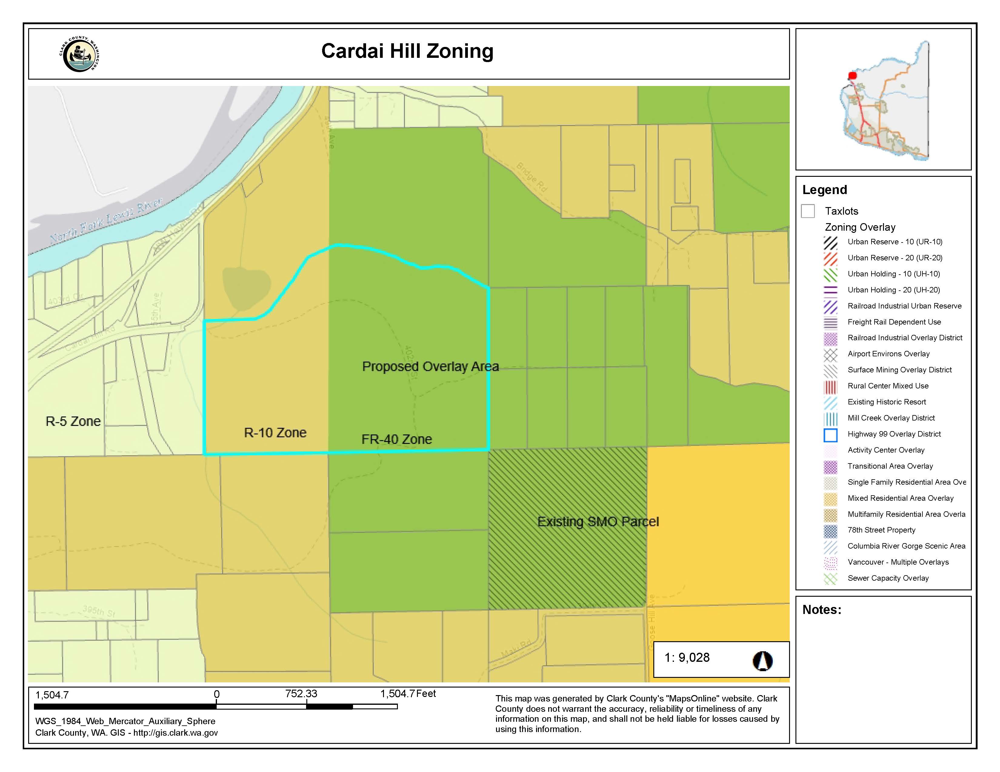
The proponent-owner is requesting to amend the comprehensive plan designation and zoning map to expand the surface mining overlay (SMO) on a 46-acre portion of a 76-acre parcel they own.
Background
The subject property is split-zoned Forest-40 (FR-40) with a Forest Tier II comprehensive plan designation and Rural-10 (R-10) with a Rural-10 comprehensive plan designation. The parcel (254798000) is approximately 76 acres total area.
The proposed amendment would apply the surface mining overlay to the easternmost approximate 46 acres of the parcel in the FR-40 zone with Forest Tier II designation. The property is owned by Cardai Hill Rock Quarry, LLC. The owners do not own other adjacent properties.
Please see staff report below under meetings for additional details.
Staff Contact
Bart Catching, Planner II
bart.catching@clark.wa.gov
564.397.4909
Public Meetings
Meeting information and project materials will be posted here.
County Council Meetings
Planning Commission Meetings
Dec. 15, 2022 Planning Commission Hearing at 6:30 p.m. in person at 1300 Franklin Street, Vancouver, 6th Floor Training Room and virtually via Webex. Additional meeting details and information on how to join remotely can be found on the Planning Commission's webpage.
Planning Commission Recommendation
- DNS
- Presentation
- Staff Report
- Maps
- DNR Aggregate Inventory Map
- Applicant Submittal
- GeoDesign 2018 Aggregate Reserves Study
- Cardai Hill Soils Geology Report
- Developer's GIS Packet, Part 1
- Developer's GIS Packet, Part 2
- Supporting Documents
- Transportation Analysis
- Public Comments to Date
Dec. 1, 2022 Planning Commission Work Session at 5:30 p.m. in person at 1300 Franklin Street, Vancouver, 6th Floor Training Room and virtually via Webex. Additional meeting details and information on how to join remotely can be found on the Planning Commission's webpage.
